
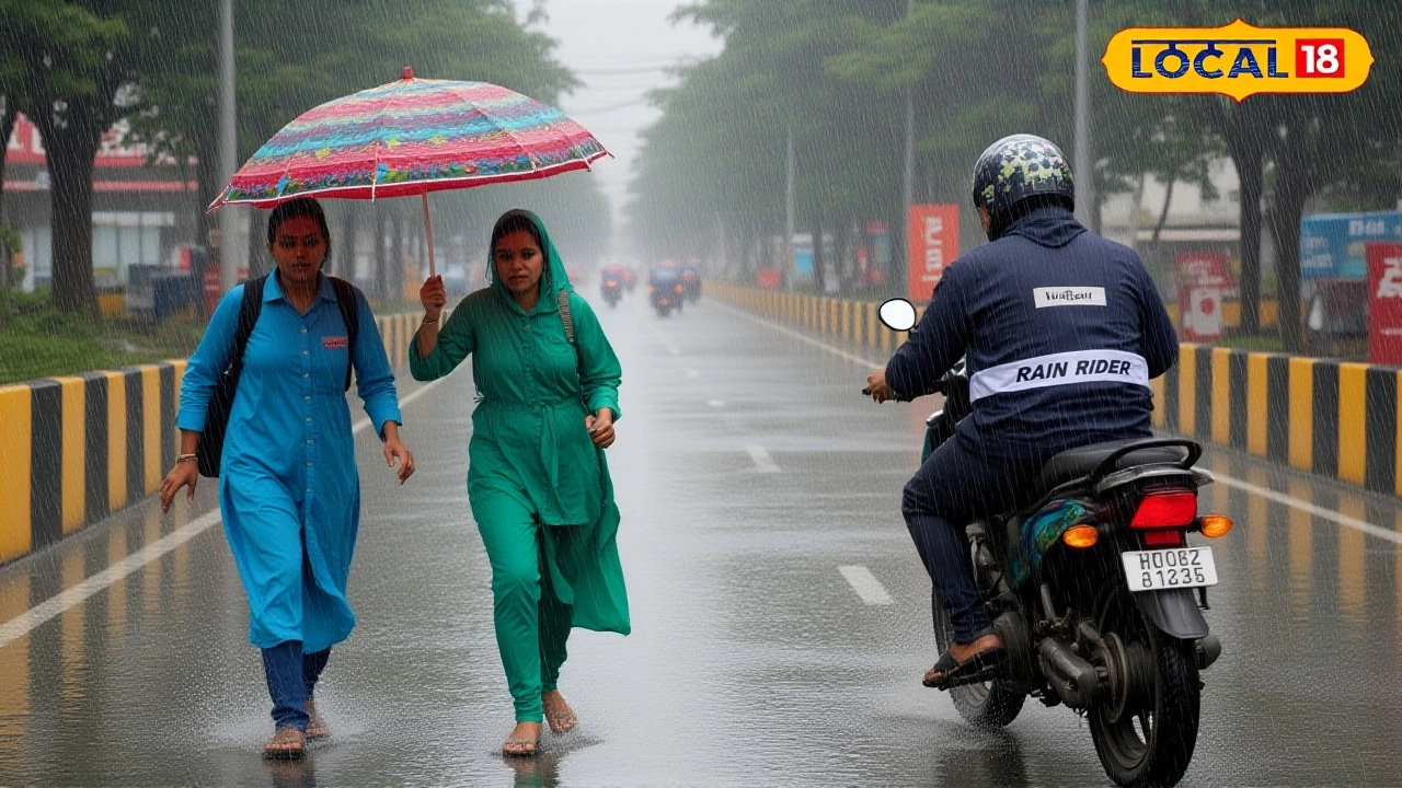
When India Meteorological Department released its October 5, 2025, warning, residents across Uttar Pradesh braced for an unusual deluge. The agency cites a western disturbance marching north‑eastward, promising thunderstorms, hail and gusty winds that could topple trees and flood streets.
Background: Western Disturbances and Regional Weather Patterns
Western disturbances are fast‑moving low‑pressure systems that originate over the Mediterranean, trek across Pakistan and India, and often unleash rain on the sub‑continent’s northern belt during winter and early spring. This time, the disturbance arrived earlier than usual, slipping into the North‑West Indian plains in early October. Historically, such systems bring modest showers, but the current one is packed with a deep depression that battered the east coast just days before.
On October 2, the depression slammed Gopalpur in Odisha with wind gusts hitting 73 km/h. The same pulse of moisture then surged inland, setting the stage for the heavy rain that now threatens the dry heart of Uttar Pradesh.
IMD's October 5 Alert: Details and District‑wise Forecast
The IMD’s press release, dated October 5, 2025, spells out a three‑day window – October 5‑7 – when “fairly widespread to widespread rainfall accompanied by thunderstorm, lightning and gusty winds of 30‑50 km/h” will be "very likely" across Northwest India.
- October 5: Isolated heavy rain expected over Jammu‑Kashmir‑Ladakh, West Rajasthan, Himachal Pradesh and Punjab.
- October 6: The bulk of the action – very heavy rain over Jammu‑Kashmir, Himachal Pradesh, Uttarakhand, Punjab, Haryana and Chandigarh. Western Uttar Pradesh, including districts like Meerut and Baghpat, will see isolated heavy showers.
- October 7: Rain tapers off, but Uttarakhand and parts of East Rajasthan may still see moderate downpours.
In Lucknow, temperatures have swung between 20 °C (68 °F) and 36 °C (96 °F) this week. The forecast now projects a spike to 80 % probability of rain on the 6th, a stark jump from the usual 5 % chance in early October.
"The system is unusually vigorous for this time of year, and the associated wind gusts could reach up to 50 km/h in the plains," said an IMD spokesperson, who asked to remain unnamed. "We have issued orange warnings for most districts and red alerts for the high‑risk zones".
Potential Impacts: Flooding, Agriculture, and Daily Life
Uttar Pradesh typically enjoys a dry October, with an average of just two rainy days and 37 mm of total precipitation. Forecasts suggest those numbers could be shattered – some districts may receive 60‑80 mm of rain in a single 24‑hour period. Such intensity raises several concerns:
- Water‑logging and localized flooding: Low‑lying urban neighborhoods, especially in Kanpur and Agra, are prone to rapid inundation.
- Agricultural damage: Late‑season wheat and mustard crops could suffer hail damage, a scenario that worries the state’s agricultural department.
- Transportation disruptions: Black‑top roads in hilly areas of Himachal Pradesh and the foothills of Uttarakhand may become treacherous, leading to traffic snarls and possible road closures.
Farmers in the Doab region have already begun shoring up their fields, tying extra tarps over vulnerable plots. "If hail hits, we could lose up to 30 % of the yield," warned Ramesh Singh, a wheat farmer from Meerut district.
Response from Authorities and Public Advice
State disaster management teams in Uttar Pradesh, Haryana and Punjab have activated emergency operation centers. Local police are on standby to assist with rescue operations, and the National Disaster Response Force (NDRF) has pre‑positioned two teams near the Himalayan foothills.
Citizens are urged to:
- Keep emergency kits ready – flashlights, batteries, bottled water and basic medicines.
- Avoid low‑lying travel routes after dusk, when visibility drops and flash floods are more likely.
- Secure loose items on rooftops, especially in areas that have seen hailstorms in recent years.
- Stay tuned to the IMD’s district‑wise GIS portal for real‑time updates.
The IMD also reminded the public that forecast accuracy diminishes as the lead period extends beyond 72 hours, so the situation on October 7 could evolve.

Looking Ahead: What to Expect Over the Next Week
While the core of the disturbance will move toward the Himalayas by October 8, its remnants could trigger scattered showers over East India through October 10. Meteorologists note a “break” in the monsoon pattern is unlikely, but the short‑term surge may bring a temporary dip in temperature, offering a brief respite from the typical early‑autumn heat.
Long‑term, the episode underscores a growing trend: western disturbances are arriving earlier and with greater intensity, a pattern some climate scientists link to shifting jet‑stream dynamics. Whether this October event is a one‑off or part of a broader shift, residents of the Indo‑Gangetic plain will be watching the skies a little more closely.
Frequently Asked Questions
How will the heavy rain affect farmers in Uttar Pradesh?
The forecasted 60‑80 mm of rain could damage late‑season wheat and mustard, especially if hail occurs. Farmers are advised to protect crops with tarps and to monitor soil moisture to avoid water‑logging, which can root‑rot vulnerable plants.
What areas are under the IMD's red warning?
Red alerts have been issued for Jammu‑Kashmir, Himachal Pradesh, Uttarakhand, Punjab and the combined region of Haryana‑Chandigarh for October 6, where very heavy rain and hail are most likely.
Will the western disturbance cause flooding in major cities?
Cities like Lucknow, Kanpur and Agra are prone to water‑logging on heavy downpours. Authorities have warned that low‑lying neighborhoods could see flash floods, so residents should avoid travel after dusk and keep emergency supplies handy.
How reliable are the forecasts beyond three days?
The IMD notes that forecast confidence drops after 72 hours. While the core disturbance will likely dissipate by October 8, scattered showers may linger, so updates should be checked regularly on the IMD’s GIS portal.
What safety measures should commuters take?
Commuters should avoid routes near rivers or low‑lying bridges, allow extra travel time, and keep mobile phones charged. In hilly districts of Himachal Pradesh and Uttarakhand, stay away from exposed ridges where gusty winds can be hazardous.